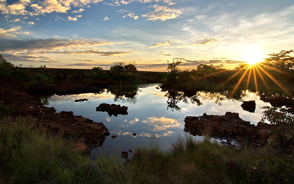
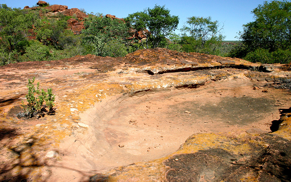
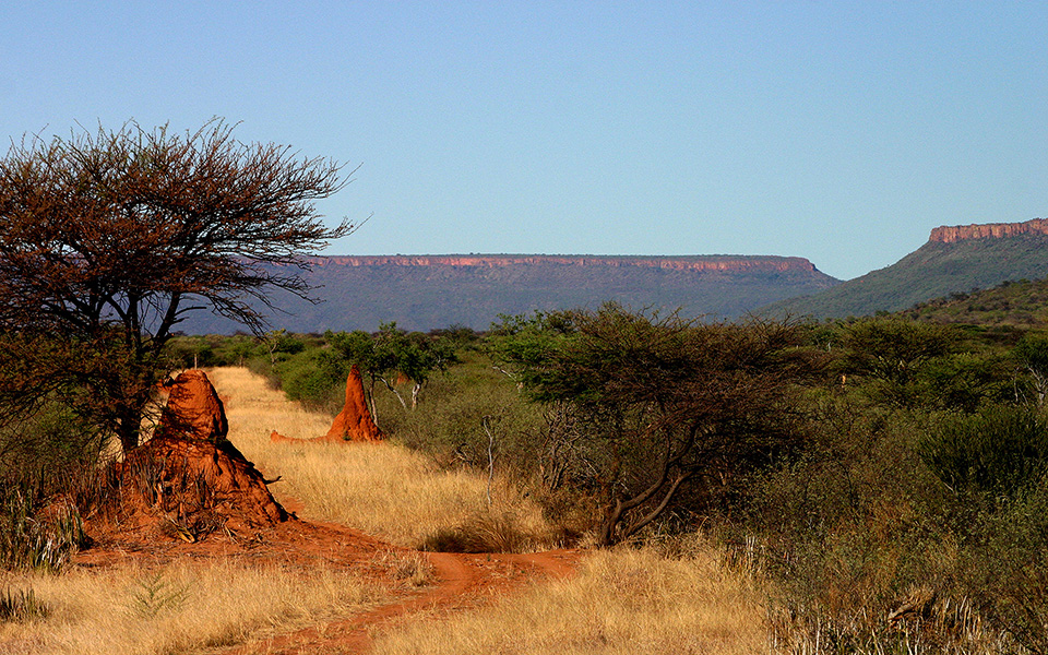
Home Geology

Stacks of plates

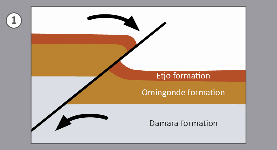
The Waterberg was born about 130 million years ago, when the original continent of Gondwana broke apart. South America and Africa were separated in the region of what is today Namibia. Although the Waterberg is far from the rupture zone, the tremendous forces at work inside the earth could be felt at the Waterberg. A rupture of the earth’s surface had occurred here before Gondwana broke apart. Geologists call it the Waterberg disturbance.

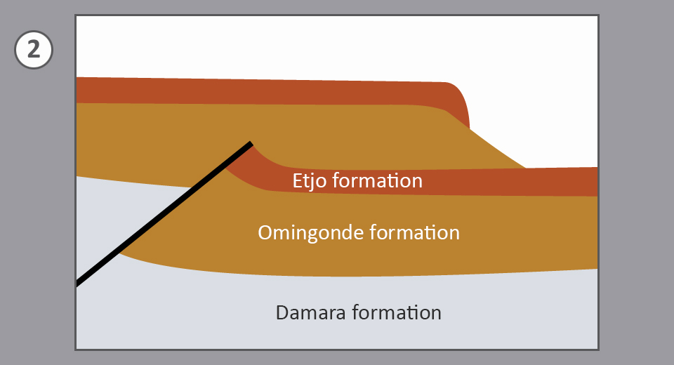
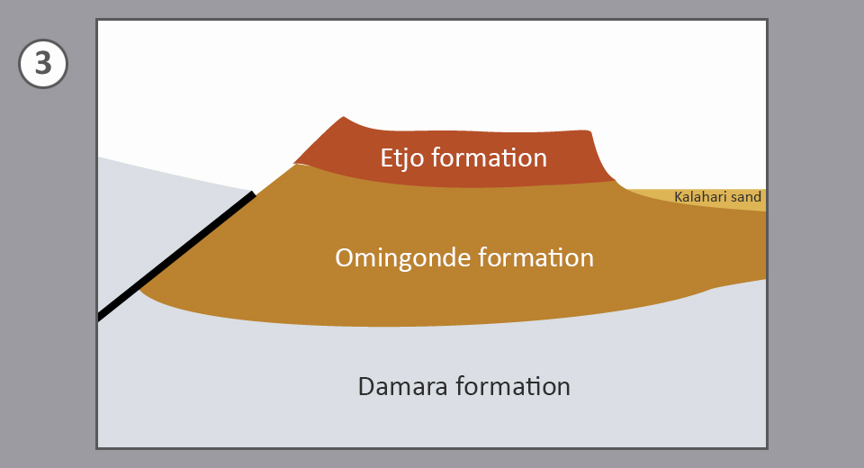
The crust of the earth northwest of the disturbance was lifted hundreds of metres and shifted over the crust in the southeast. The top plate eroded over millions of years, just like the surrounding formations in the southeast. The lower plate, protected from erosion by the upper plate, is now visible as a plateau: the Waterberg.

  • Formation of the Waterberg

    Formation of the Waterberg. Sketch: Waterberg Wilderness, Source: "Namibias faszinierende Geologie" by Nicole Grünert

  • Formation of the Waterberg

    Formation of the Waterberg. Sketch: Waterberg Wilderness, Source: "Namibias faszinierende Geologie" by Nicole Grünert

  • Formation of the Waterberg

    Formation of the Waterberg. Sketch: Waterberg Wilderness, Source: "Namibias faszinierende Geologie" by Nicole Grünert

The reddish topset bed consists of sandstone from the so-called Etjo formation. These are petrified dunes of a desert, which covered the greater part of Namibia 190 million years ago. The sandstone rests on the Omingonde formation, a compressed underground of an even older landscape of lakes, containing conglomerate, sand- and mudstone.

  • Red Etjo sandstone

    Red Etjo sandstone. Photo: Waterberg Wilderness

When it rains at the Waterberg, the porous Etjo sandstone absorbs the water like humungous sponge. The underlying impermeable Omingonde layer slightly slopes from the northwest to the southeast. Absorbed water thus escapes at the south-eastern edge of the Waterberg in so-called layer springs. The Waterberg, i.e. water mountain, gets its name from these springs.

  • Basin on the Waterberg plateau filled with water

    Basin on the Waterberg plateau filled with water... Photo: Waterberg Wilderness

  • Basin on the Waterberg plateau without water

    ... and basin on the Waterberg plateau without water. Photo: Waterberg Wilderness

  • Spring water feeds a stream

    Spring water feeds a stream. Photo: Waterberg Wilderness

Further erosion has divided the current Waterberg into three parts – the “little Waterberg” south of the C 22 road to Okakarara, the Omuverume plateau on the northern opposite side and the main plateau, which is situated further northeast and separated from the Omuverume plateau by a saddle-shaped cut. On average the plateau is 1,700 metres above sea level and towers up to 200 metres over its surroundings. (Source: "Namibias faszinierende Geologie" by Nicole Grünert).

  • Saddle-shaped cut (back) between Omuverume plateau

    Saddle-shaped cut (back) between Omuverume plateau (left) and main plateau (right). Photo: Waterberg Wilderness

Experience

Explore the intriguing geology of the Waterberg from the state-owned rest camp on the trails to the plateau or to the region of the Otjozondjupa spring (calabash spring) on the slope. Waterberg Wilderness private nature reserve offers a guided tour onto the plateau and a hiking trail in the valley leading to the Otjosongombe spring (cattle spring).